Our holiday weekend started off hot and dry statewide but it will end significantly cooler with scattered showers and thunderstorms, especially on Monday.
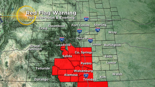
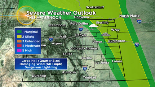
Today is a transition day with windy and warm weather for most areas. We are worried about two things this afternoon … high fire danger in south-central Colorado and the potential for some strong to severe thunderstorms this afternoon to the north and east of Denver.
Any thunderstorms that develop will have the potential for large hail and damaging winds. But we also can’t rule out an isolated tornado.
Looking ahead, your Memorial Day will consist of partly to mostly cloudy skies statewide with increased relative humidity and cooler temperatures.
We are also expecting more widespread thunderstorms tomorrow, some of which could be strong to severe. That threat will include metro Denver and most of the I-25 urban corridor.
Meteorologist Chris Spears travels weekly in the CBS4 Mobile Weather Lab reporting about Colorado’s weather and climate.